|
|
||||||||||||||||||
 |
||
|
|
||
|
Part One: Reykjavik to Budir
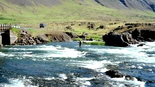
Regarding Iceland's roughly round shape as the dial of a clock, with a few bulges especially in the northwest, Reykjavik is located at about eight o'clock. Our destination, Budir is at about ten o'clock. Heading north out of Reykjavik on Route One, through the foothills of Mount Esja, you soon reach the first of two major fjords. It is possible to cross using the new toll tunnel and hug the coast, but as time was not important we took the itinerary advice and went the longer way down the beautiful fjord valley eventually crossing where it narrowed to a river bridge.
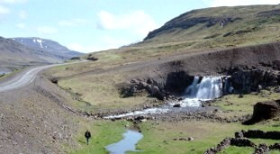
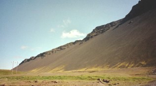
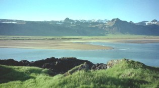
At the second fjord we turned left off Route One, on to road number 54, heading into one of the north west bulges. This is the Snaefellsnes peninsular near the end of which is the Snaefelljokull glacier. Our destination Budir is some way before the glacier. With easy driving conditions we had no cause to hurry, and indeed every reason to linger and take in the stunning landscapes which kept unfolding as we progressed.
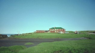
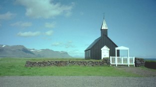
The Icelandic names of the towns and landmarks we passed were nearly always unpronounceable and even those we believed were within our capability later emerged to be far from correctly spoken. Additionally there are a few extra letters in the Icelandic alphabet which are not included in English fonts. Some letters have German or French type accents, and frequently occurring, for example in Budir, is what on an Icelandic printed page looks like a curly d but should be pronounced as th. Guide books are inconsistent and as Budir was written in our itinerary, Budir it stayed in our minds.. Our accommodation was isolated in the extreme. A red building with a green roof and only the tiny Black Church nearby for company. We had passed several small churches of quaint or sometimes futuristic design already and they were to be landscape features throughout our stay in Iceland.
Being there in mid-June we had the benefit of 24-hour daylight with sunsets near to midnight and sunrises in the early hours. As we were staying two nights at Budir we had a full day to explore the peninsula before moving on. Iceland is nearly half the size of the UK but its population is less than a quarter of a million, of which 90000 live in Reykjavik. There are few other towns of significant size and mostly Icelanders live in very small communities around the coastline. They are reputed to be among the world's longest livers but the ones you see are nearly all young.
We are beginning to recognise some words which keep reappearing at the end of place names. Vik for example means a bay, jokull - a glacier, foss - a waterfall, nes a peninsula. The good news is that the young speak English fluently and communication is no problem. Iceland is said to be one of the youngest land masses, geologically speaking, having been formed less than 20 million years ago. That sounds quite old enough for me, but it is still volcanically active and changing shape. It lies astride the mid-Atlantic ridge and is, it seems, being split in two at the rate of 2 cm a year. Eruptions, mostly minor, occur every few years and the one in 1963 threw up Surtsey, a new island of about a square mile just off the south coast.
We are not quite in the arctic circle which lies just above the northern tip of the mainland. The weather was predicted to be very changeable and this it certainly proved to be. June is not quite the best time to visit, July being favoured, but there is more pressure on the limited tourist resources then. |
|
Click below for Part Two |
|||||||||
|
to Iceland Clockwise |
|||||||||
|
Magic and Logic ................... End of Page |
|||||||||